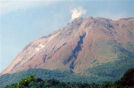
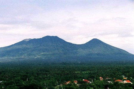
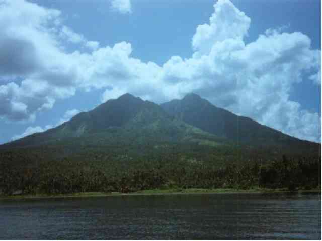
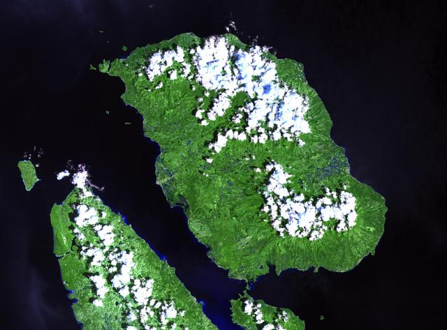
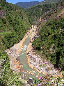
1. Babuyan Claro is a volcano located in the Babuyan Islands, an archipelago in the Luzon Strait north of Luzon Island, in the Philippines. It is separated from Luzon by the Babuyan Channel, and from the Batanes Islands to the north by the Balintang Channel. It is in the province of Cagayan in the Cagayan Valley Region. Location : Babuyan Islands, Philippines Elevation : 843 m (2,766 ft)Prominence : 843 m (2,766 ft) Coordinates : 19°31′24″N 121°56′24″E Type : Stratovolcano Age of Rock : Unknown Last Erruption 1917 Physical Features Babuyan Claro is classified by volcanologists as a stratovolcano with an elevation of 843 m (2,766 ft) and a base diameter of 920 m (3,018 ft). It has one hot spring called Askedna . Hot Spring which is located at the southern basal slope of Babuyan Claro. It has a temperature range of 44.6 to 50.2°C. The water in Askedna hot spring is slightly acidic and the silica content is relatively high since the spring flows directly from lava flow deposits. The spring water can be classified as near-neutral sodium chloride brine. Babuyan Claro has four morphologically-fresh volcanic edifices: Mt. Cayonan in the south, Mt. Naydi and Mt. Dionisio in the southeast and Mt. Pangasun, a stratovolcano which has two very well-preserved craters 300 and 400 m in diameter. Eruptions Babuyan Claro has erupted on four occasions in historical times: in 1831, 1860, 1913 and 1917. All eruptions were either strombolian or phreatomagmatic. In July 1993, there were reports of earthquakes and an alleged drying up of vegetation at the upper slopes and summit area of the volcano but volcanologists said the earthquakes were of tectonic origins and there was no significant change in the volcanic activity. In February 2004, there were reports of grayish steam clouds hovering above the summit but volcanologists from the Philippines Institute of Volcanology and Seismology (Phivolcs) said the seismic swarm was of tectonic origin and the steaming activity was only wispy to weak. Babuyan Claro is one of the Active volcanos in the Philippines and is part of the Pacific Ring of Fire 2. Mount Banahaw (alternative spelling: Banáhao) is one of the active volcanos in the Philippines. Part of a volcanic group, it is located along the boundary of Laguna and Quezon provinces, on the island of Luzon, in the Philippines. The mountain and its environs are considered sacred by the local residents because of its "holy water", which allegedly have beneficial qualities, issuing forth from local springs and its "puwesto s, or the "holy sites". These are composed of unique, natural features such as rocks, caves and springs with shrines erected in, on or around them, their location having been revealed to a man in the Spanish Era by the "Santo Boses" or the "Holy Voice". It has another of this mountain and it was named as Mount Banahaw de Lucban. Location : Lucban, Quezon and Physical characteristics Height: 2,158 m asl Crater: breached by 1.5 km x 3.5 km at its southern rim; 210 m deep Major adjacent volcanic edifices: Mount San Cristobal (at western slope) Mount Banahaw de Lucban (at northeastern slope) Buho Masalakot Domes (at southwestern slope Mount Mayabobo Mars : Lake Dagatan and Lake Tica Thermal Areas: Tiaong-San Pablo hot/warm springs, Bakia warm/cold springs, Sampaloc warm springs, Mainit hot/warm springs, Cagsiay hot/warm springs Composition of Lava: Andesitic Etymology 1.The term Banahaw is not known to many people but some beliefs attribute it to the description of a holy being. This mountain has a rock with the footprint of an unknown being and supposedly, this was the origin of the name of the mountain. Banahaw is very close to the modern Tagalog words banal (holy, sacred, divine) and daw (a word used in quoting another speaker; when appended to sentences, daw indicates slight disbelief or uncertainty in the veracity of the quotation's content). Combined, the two words mean "[it is] probably/supposedly sacred". The way the phrase was transcribed in Baybayin, the ancient syllabary used in writing Tagalog prior to the introduction of the Latin alphabet, finally produced the term " Banahaw. Hiking activity on Banahaw Mt. Banahaw is a traditional pilgrimage site for locals, considered by many to be a "holy mountain" or spiritually-charged location. It is also popular among mountain climbers being the closest >2000-meter mountain to Manila. Hiking activity peaks during Holy Week of each year, with climbers numbering in the thousands. At least four trails exist, from Dolores, Sariaya, and other towns in Quezon. The most frequently trails are the Cristalino and the Tatlong Tangke, taking an average of 9 and 5 hours, respectively. These two trails originate from Barangay Kinabuhayan, Dolores, and meet near the summit of Banahaw. At the summit, which is actually a rim encircling the caldera, viewpoints are numbered as Durungawan I,II, and III. These viewpoints are the usual destination for pilgrims and hikers. Other points of interest include the "Kuweba ng Diyos Ama" (Tagalog: Cave of God the Father) and the spring at Brgy. Kinabuhayan, said to have curative powers.3. Biliran is a compound volcano / volcanic islands that makes a large mountainous island just north of the island of Leyte (left center to center). The large island of Samar is in the bottom right. Biliran's single historic eruption was from a flank vent in 1939. There are five solfatara fields on the island. The solfatara on the west side of Mt. Guinon contained more than 400 tones of sulfur in 1880. Locations : Visayas,Philippines Province: Biliran Region VIII Nearby Cities/Towns: 1.Kawayan, Biliran 2. Almeria, Biliran 3. Culaba, Biliran 4. Maripipi, Biliran 5. Naval, Biliran 6. Caibiran, Biliran 7. Biliran, Biliran 8. Cabucgayan, Biliran Classification: Active Current Summit Activities: Solfataric Elevation : 1,301 m(4,268ft) Coordinates : 11°31′23″N 124°32′06″E / 11.523°N 124.535°E Type : Complex Volcano Last Erruption : 1939
Physical features Hotsprings: 1. Central Biliran - Libtong Thermal Areas (12 hot springs and one bubbling pool) 2. North Biliran - Panamao Thermal Area 3. Anas Thermal Area 4. South Biliran - Kalambis Thermal Area Adjacent Volcanic Edifice: 1. Panamao (107 m asl) 2. Gumansan (1064 m asl) 3. Lauan (1187 m asl) 4. Suiro (1301 m asl) Geological features Rock Type: Hornblende andesite containing greenish and black hornblende Tectonic Setting: Biliran Volcano is part of the curvilinear belt of Quaternary volcanoes in eastern Philippines, parallel to o Phil. Trench to the east. Volcanic activity
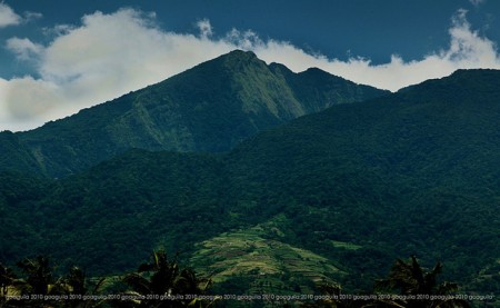
4. Binubulauan is a remote stratovolcano, part of the volcanic Cordillera Central mountain range. Binubulauan is in the province of Kalinga, in the Cordillera Administrative Region, one of the regions of the Philippines, in the central north of the island of Luzon, in the Philippines. Location : Kalinga Province, Philippines Range : Cordillera Central Coordinates : 17°18′40″N 121°06′13″E / 17.310982°N 121.103668°E Elevation : 2,329 m (7,641 ft) Type : Stratovolcano Age of Rock : Holocene Volcanic arc / belt : Cordillera Central Volcanic Arc Last Erruption : 1986
Current Listings The Philippines Institute of Volcanology and Seismology (PHIVOLCS) lists Binubulauan (under a variant spelling) as one of the Philippines' inactive volcanoes. Details given on the PHIVOLCS website are : *Name Binuluan, Co-ordinates N 17°15' E 121°08', Province Kalinga-Apayo, Region Cordillera Administrative Region, Elevation 2329 meters ASL PHIVOLCS also lists Ambalatungan at almost the same location. The Smithsonian Institution's Global Volcanism Program does not list Binubulauan separately but includes Binuluan as a cone subfeature in the listing for Ambalatungan:
Ambalatungan Locals living in the surrounding barangays in the Pasil River valley in 2007 and 2008 were unfamiliar with the name Ambalatungan. Reasons for the original appellation need further investigation.
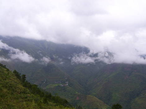
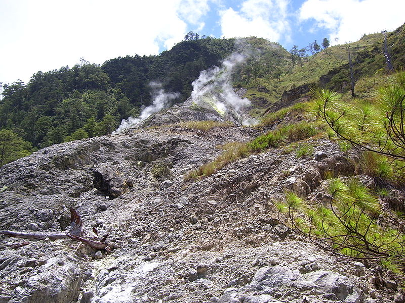
Craters and Cluster 2007 and 2008 groundwork indicated that the Smithsonian's description of 'craters' is unsatisfactory. Ground expeditions and discussions with local elders in a 10 kilometre radius around Binubulauan in 2007 and 2008, did not disclose any craters with volcanic activity. Ground expeditions with GPS geomapping and photography show that the areas described as craters in the Smithsonian listing are not craters in the usual or volcanological sense of the word. It seems the description 'a cluster of volcanoes' in the Smithsonian's listing is based on the use of the word 'crater', which is inappropriate. It therefore appears that the description 'cluster of volcanoes' is similarly inappropriate here. Because there does not appear to be a cluster of volcanoes, the use of the word group to describe the volcanic forms here also appears inaccurate. Satellite terrain maps indicate Binubulauan could be the prehistorical primary with perhaps some daughter vents associated. Binubulauan is usually covered in cloud or mist and so photographs from the few vantage points are difficult to obtain. But when Binubulauan does appear, an argument for daughter cones on the northwestern flank seems tenable. The village of Bangtitan in Upper Uma is a good vantage point for views and photography of Binubulauan on the rare occasions when the primary peak is not mist-enshrouded. Eruption In 2007 and 2008, ninety and one hundred year old elders in Tinglayan and Tulgao said the loss of life in 1952 was caused by an eruption during a typhoon with the collapse of a natural earth bank below Sugo-oc fumarole field, high on the northern side of the Bunog River valley, with the consequent mudslide burying a few houses below and killing maybe 12 people or thereabouts. Sugo-oc is on the southern flank and is largely inaccessible from the northern and western flanks of Binubulauan. Also Sugo-oc is not mentioned by name or description in the Smithsonian's listing. If information about the 'eruption' had been originally obtained from the Pasil River valley people, there could have been some difficulty in explaining to non-Kalingan people the precise location of the fatalities and their cause in a different, unconnected, valley. In 2007 and 2008, people in southern Kalinga around Binubulauan spoke of an 'eruption' at Sugo-oc in 1986 or 1987. During the Abra earthquake at 20:16 hours on Sunday 13 January 2008, buildings in Tinglayan shook and windows rattled for about 10 seconds. When speaking in English, the locals there at the time called this an 'eruption'. Gentle questioning of locals over months led to the conclusion that there are difficulties in communicating the difference between an eruption and an earthquake. Further inquiries in southern Kalinga in December 2008 - January 2009 resulted in reports that there was an earthquake in 1986 which was felt throughout Labuagan Municipality and Tinglayan Municipality, and at the same time there was an eruption at Sugo-oc resulting in the ejection of ash and rock from Sugo-oc. Three people in Dananao village were killed by ejected rock during this eruption. Because of the eruption and deaths, there was a large migration out of Dananao village with the Dananao people taking possession of land on the Tubuk to Aurora road in eastern Kalinga and resettling there. Further details will be sought during a field expedition to Dananao and Sugo-oc when current intertribal unrest decreases. Details about the eruption in 1952 are still scant. There may have been an eruption or there may have been a lahar at the Sugo-oc sulfur fumarole field located near the villages of Dananao and Sumadel, with loss of some dwellings and about 12 lives. There was a projectile eruption at the same location in 1986 killing three people. In 2009, the Sugo-oc fumarole field is still active. Binubulauan is one of the active volcano of the Philippines
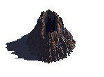
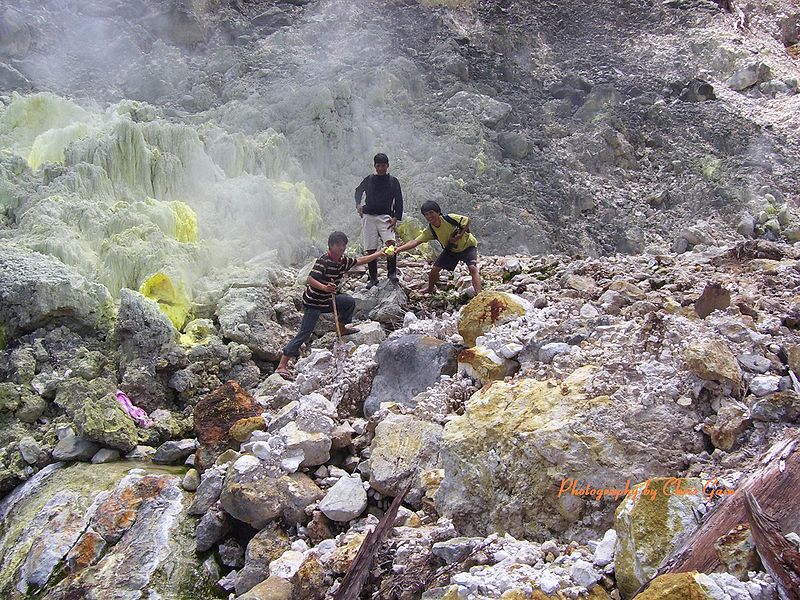
5. Bud Dajo (Mt.) Dajo is a lava cone of an extinct volcano at an altitude of 2100 feet six miles east of Jolo. The crater in the summit has a circumference of 1800 yards. The crater was a natural fortress; hence, a favorite shelter or hide-away for Moro "tax evaders", who were mostly poor people. Soon families were staying in the crater. In 1906, the Taosugs were quite disenchanted with their Sultan and prominent datus. They hated the Americans and their man-made laws. When the US military patrols come to collect tax, they ran for cover.
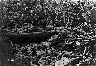
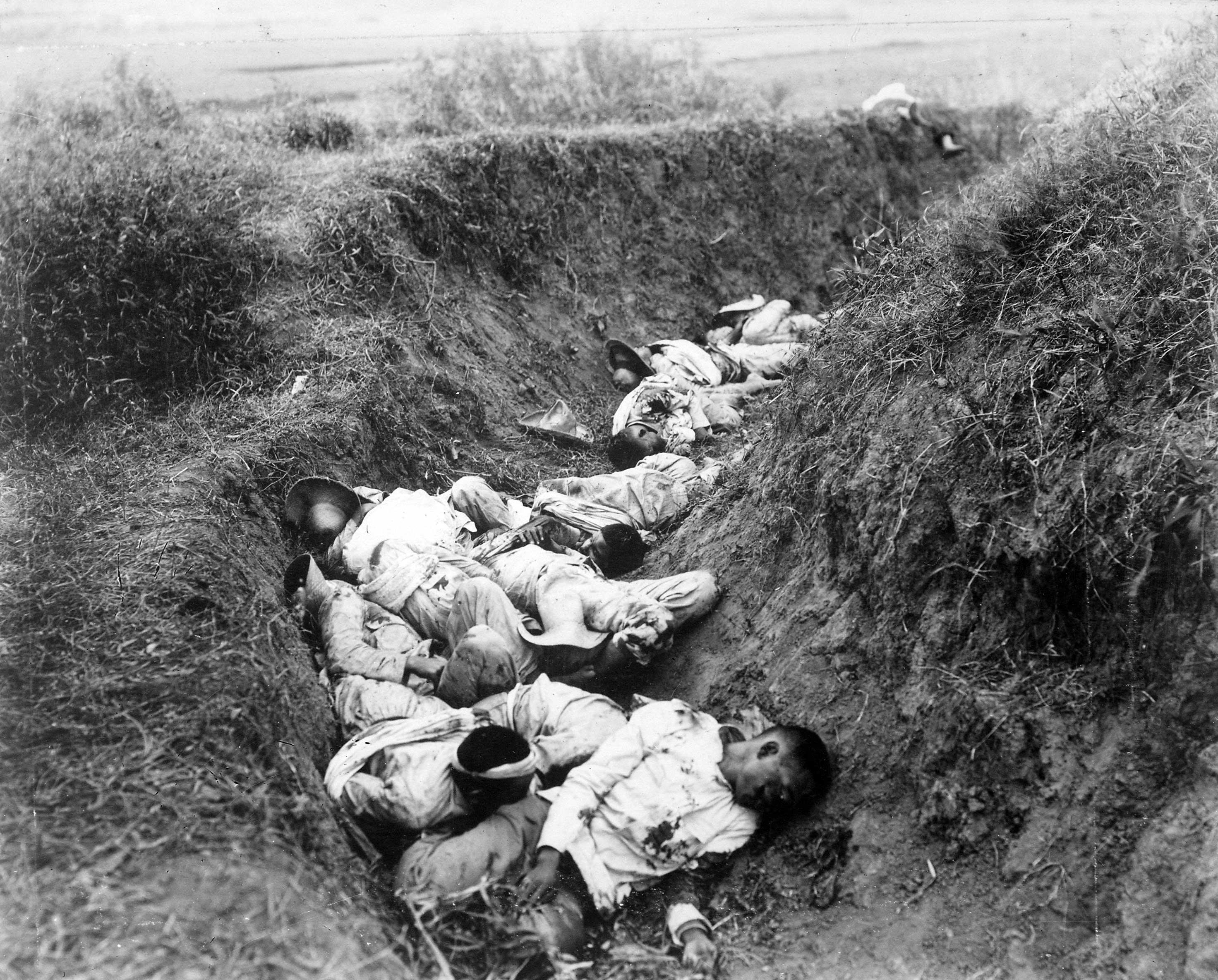
Bud Dajo (Tausūg: Būd Dahu; Spanish: Bud Dajó), one of the active volcanos in the Philippines, is located 8.05 aerial km southeast of the town of Jolo, on the Philippine island of Jolo. Location : Patikul, Jolo Sulu Autonomous Region Mindanao Elevation : 620m Base Diameter : 9.5 km Type : Cinder Cone Crater Lake : Lake Panamao Adjacent : Matanding (400 m, NE) Rock Type : Basalt Tectonic Setting : Sulu Arc Volcanic Activity Number of Historical Eruptions : 2 Year : 1641 and 1897 Eruption Type : phreatic Current hotsprings * * * * By March 1906 A Complete Massacre in Mount Bud Dajo , more than a thousand Moros -- men, women and children, made their way to the crater. Gen. Wood would not have any of their nonsense. He ordered his officers to gather in Jolo. Col. Duncan with about 800 officers and men from the 6th and 19th infantry, the 4th Cavalry, the 28th Artillery Battery, the Sulu Constabulary and sailors from the gunboat Pampanga, with mountain guns, rifles, bayonets, fast-firing pistols and grenades launched the assault on March 5. The thousand or so Moro men, women and children were armed with kris, barungs and spears. By March 7, the smoke of battle has cleared. The people in the crater fought bravely, to the last Moro. There were no survivors. The Americans lost two dozen men and some seventy wounded. It was a complete massacre. Filipino Casualties in the 1st day of war... Filipino Muslim buried in the crater of Mount Bud Dajo.
|
||